

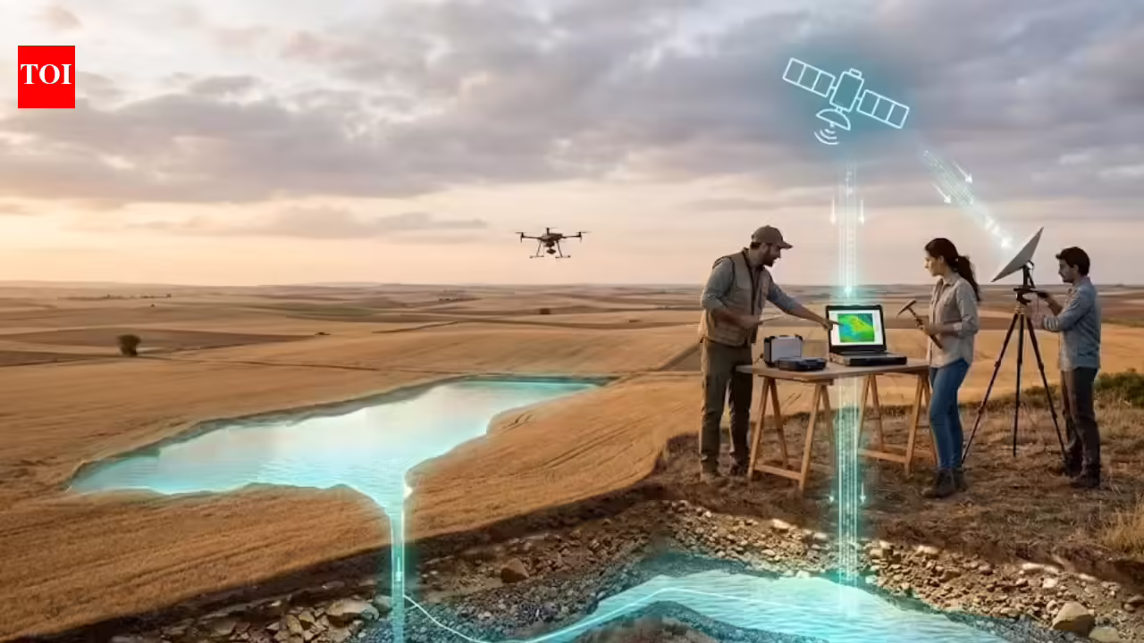

Researchers have used cutting-edge satellite technology to find a large underground aquifer beneath Spain’s main agricultural area. This discovery arrives at a crucial time, as water scarcity and long droughts become more common in the Mediterranean region. Scientists employed Synthetic Aperture Radar (SAR) along with gravity-mapping data, allowing them to see through the ground and pinpoint water-filled layers that traditional methods missed. This hidden water source could be vital for local irrigation and reviving ecosystems, especially in the struggling wetlands of Castilla-La Mancha. The finding highlights how space-based observation is increasingly important in managing Earth’s limited freshwater resources and securing food supplies in dry areas.
InSAR technology uncovers groundwater changes beneath Spain’s farmland
According to the research published in Research Gatethe main discovery uses InSAR, a radar technology that detects small changes in ground height. This helps scientists understand the health of aquifers. As aquifers either lose or gain water, the ground shifts. Researchers studied these shifts to figure out how much water is in Spanish reserves, especially those in detrital aquifers where excessive use has caused the ground to sink in the past. This approach offers a way to check groundwater levels and movement across large farming areas without drilling holes everywhere.
How ancient floodplain sediments preserve vital aquifers
Recent studies have uncovered separate water systems, such as the Planas de Raimat-Monreal reserve, covering about 31 square miles. These reserves lie within layers of ancient floodplain sediments and gravel deposits that hold water. In contrast to neighboring systems, these isolated aquifers lack lateral connections. Therefore, tracking their inputs and losses becomes simpler. This is essential for managing agricultural districts sustainably since these regions depend on these ‘buried legacies’ of older landscapes.
The vital role of GRACE satellite records
Scientists use the GRACE satellites to confirm large-scale water bodies. These satellites detect changes in Earth’s gravity field due to shifts in water mass. In regions like Spain and other dry areas, this information distinguishes between shallow soil moisture and deep, ancient water reserves. According to NASA, over a decade, GRACE has built a data record that helps water managers see long-term trends in how underground resources are being used.
The role of satellite-based crop mapping
The American Society for Horticultural Science believes that using Remote Sensing-based Irrigation Water Accounting (RS-IWA), using Sentinel-2 and Landsat data for better accuracy, like multispectral reflectance and vegetation indices, is key to encouraging sustainable farming. In Spain, scientists are creating ways to map irrigated crops and figure out their water needs from space. This helps them monitor aquifer depletion closely. They aim to keep water withdrawal within safe limits so that the land doesn’t permanently sink in areas where water demand is high.