
Pilibhit: Pilibhit administration on Thursday launched a campaign urging farmers across 16 village panchayats to voluntarily donate land to restore the natural flow of the Gomti river along its 47.2-km stretch in the district.The initiative, led by district magistrate Gyanendra Singh, seeks to address decades-old anomaly dating back to 1952, when the entire river course was mistakenly recorded in farmers’ names during the preparation of revenue records after Independence. As a result, the river was left without land officially registered in its own name.Originating from Phulhar Lake in Madhotanda village, the Gomti flows nearly 960 km through several districts of Uttar Pradesh before merging with the Ganga in Ghazipur. Officials are also considering compensatory land exchanges to encourage farmers to cooperate with the restoration project.Over the years, cultivation along the narrow river channel has obstructed the river’s natural flow. During summer, the river dries up along a 5-6 km stretch as artesian wells in Phulhar Lake have either choked or release only minimal water, insufficient to sustain the stream. To maintain water flow, the administration currently feeds the lake through solar-powered pumps and canal water diverted through a man-made channel.Despite restrictions on summer paddy cultivation, farmers continue using the riverbed for farming. Experts believe such cultivation, dependent entirely on groundwater, has contributed significantly to falling groundwater levels in the region.“We are preparing a list of farmers owning land along the river track and will persuade them to voluntarily donate it. A panel will also identify vacant land for exchange,” said the DM. He added that experts from the Indian Institute of Hydrology and the Indian Institute of Remote Sensing would study the condition of the lake’s artesian wells.Earlier this week, the DM and senior officials manually excavated parts of the river channel to promote voluntary participation in clearing encroachments.
Pilibhit admin launches drive to restore Gomti river’s natural flow. Bareilly News
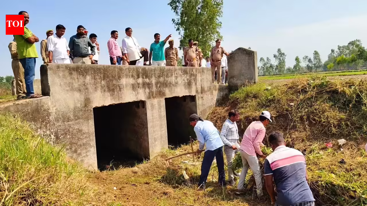
Pilibhit: Pilibhit administration on Thursday launched a campaign urging farmers across 16 village panchayats to voluntarily donate land to restore the natural flow of the … Read more
by
No comments on Pilibhit admin launches drive to restore Gomti river’s natural flow. Bareilly News
2 minutes
Read Time
About the Author
Tags: 16 village panchayats, 47.2-km stretch, artesian wells, canal water diversion, compensatory land exchange, district magistrate Gyanendra Singh, falling groundwater levels, farmers, Ganga river confluence, Ghazipur, Gomti river, Gomti river natural flow restoration, groundwater depletion, Indian Institute of Hydrology, Indian Institute of Remote Sensing, Keshav Agarwal, land donation drive, Madhotanda village, man-made channel, Phulhar Lake, Pilibhit, Pilibhit administration, post-Independence revenue records, revenue records 1952, river channel excavation, river encroachment removal, river restoration campaign, riverbed farming, solar-powered pumps, summer paddy cultivation restrictions, Uttar Pradesh, village panchayats
Previous Post
Next Post
Leave a Reply
Latest News


Stay Connected
Categories
Tags
Bhubaneswar latest news Bhubaneswar news Bhubaneswar news live Bhubaneswar news today bjp Breaking news Chennai latest news Chennai news Chennai news live Donald Trump Goa latest news Goa news Goa news live Goa news today Google news Guwahati latest news Guwahati news Guwahati news live Guwahati news today India India News India news today ipl IPL 2026 Lucknow New Delhi Patna latest news Patna news Patna news live Patna news today Rajasthan Royals Ranchi latest news Ranchi news Ranchi news live Ranchi news today Ranveer Singh Royal Challengers Bengaluru Strait of Hormuz Today news Today news Bhubaneswar Today news Goa Today news Guwahati Today news Patna Today news Ranchi Uttar Pradesh
About the Author
AF themes
Easy WordPress Websites Builder: Versatile Demos for Blogs, News, eCommerce and More – One-Click Import, No Coding! 1000+ Ready-made Templates for Stunning Newspaper, Magazine, Blog, and Publishing Websites.

Search the Archives
Access over the years of investigative journalism and breaking reports
You May Have Missed